SFr. 26.90
€ 29.05
BTC 0.0005
LTC 0.459
ETH 0.0091


bestellen

Artikel-Nr. 39463707


Diesen Artikel in meine
Wunschliste
Diesen Artikel
weiterempfehlen
Diesen Preis
beobachten

Weitersagen:


Autor(en): 
  • DK
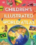
  • Children's Illustrated World Atlas 
     

    (Buch)
    Dieser Artikel gilt, aufgrund seiner Grösse, beim Versand als 3 Artikel!


    Übersicht

    Auf mobile öffnen
     
    Lieferstatus:   i.d.R. innert 2-7 Tagen versandfertig
    Veröffentlichung:  Juni 2024 - NEU!  
    Genre:  Kinder- / Jugendbücher 
     
    Children’s / Teenage general interest# Places and peoples / Interest age# from c 9 years / JUVENILE NONFICTION / People & Places / General / People & places (Children's / Teenage)
    ISBN:  9780241659014 
    EAN-Code: 
    9780241659014 
    Verlag:  Dorling Kindersley 
    Einband:  Gebunden  
    Sprache:  English  
    Dimensionen:  H 283 mm / B 224 mm / D 16 mm 
    Gewicht:  856 gr 
    Seiten:  144 
    Bewertung: Titel bewerten / Meinung schreiben
    Inhalt:
    Take young readers on the ultimate round-the-world trip with this impressive atlas - packed full of beautiful illustrations and photographs.

    Discover the world map-by-map with this exciting world atlas book for children, featuring more than 50 maps! Each page is filled with fascinating information, facts and colourful illustrations of our world.

    Children aged 9-12 will love to learn all about the many countries, cultures and people of the world through vibrant maps. Fascinating facts, local stories, vivid pictures, and clear, satellite-based maps together make this atlas a global yet personal experience for young readers.

    This illustrated atlas book for children offers:

    - Bite-sized information giving the profiles, facts, stats and flags of every country.
    - Pictures and stories explaining the society, culture and history of each region.
    - Maps created using satellite imagery providing a clear view of the world map-by-map.
    - A variety of topics covered, including population density, wealth, and internet access shown through graphics.

    From Bangkok's floating markets to the carnival in Venice, the Children's Illustrated World Atlas brings together views from windows all over the world. This illustrated atlas not only portrays regions, such as the Siberian wastes, with beautifully detailed maps but also describes the peoples who live there.

      
     Empfehlungen... 
     Children's Illustrated World Atlas - (Buch)
     Children's Illustrated World Atlas - (Buch)
     Weitersuchen in   DVD/FILME   CDS   GAMES   BÜCHERN   


    Wird aktuell angeschaut...
     

    Zurück zur letzten Ansicht


    AGB | Datenschutzerklärung | Mein Konto | Impressum | Partnerprogramm
    Newsletter | 1Advd.ch RSS News-Feed Newsfeed | 1Advd.ch Facebook-Page Facebook | 1Advd.ch Twitter-Page Twitter
    Forbidden Planet AG © 1999-2024
    Alle Angaben ohne Gewähr
     
    SUCHEN

     
     Kategorien
    Im Sortiment stöbern
    Genres
    Hörbücher
    Aktionen
     Infos
    Mein Konto
    Warenkorb
    Meine Wunschliste
     Kundenservice
    Recherchedienst
    Fragen / AGB / Kontakt
    Partnerprogramm
    Impressum
    © by Forbidden Planet AG 1999-2024
    Jetzt auch mit LiteCoin bestellen!